Forestry
Drones enable collection of remotely sensed data for large areas of forestry, quickly and safely, making light work of difficult terrain . We use commercial enterprise drones to capture high resolution imagery to create maps and models using photogrammetry. The captured images can be used to create point clouds, orthomosaics, 3D models, digital elevation models and 2D maps. We use industry grade RTK/PPK drones giving highly accurate and reliable results. We can also collect multispectral data to assess canopy health, aiding the identification and monitoring of tree diseases such as Ash dieback, further reducing the risk to people.
Mapping & Monitoring
Drone forestry surveys are a valuable tool for forestry management. Drone data can be used to assess the health and condition of the forest, monitor canopy conditions, understory vegetation, detect pests and diseases. Thermal drones can be used to enhance ecological monitoring of forests, for example by monitoring the population of deer using an area.
Environmental Drone Services Ltd produce georeferenced, high resolution 3D photogrammetry models and 2D orthomosaic maps of forests, which easily import into GIS applications, for forestry management decisions and collaborations. Our high resolution aerial photography aids species identification for forestry composition.


Canopy Health
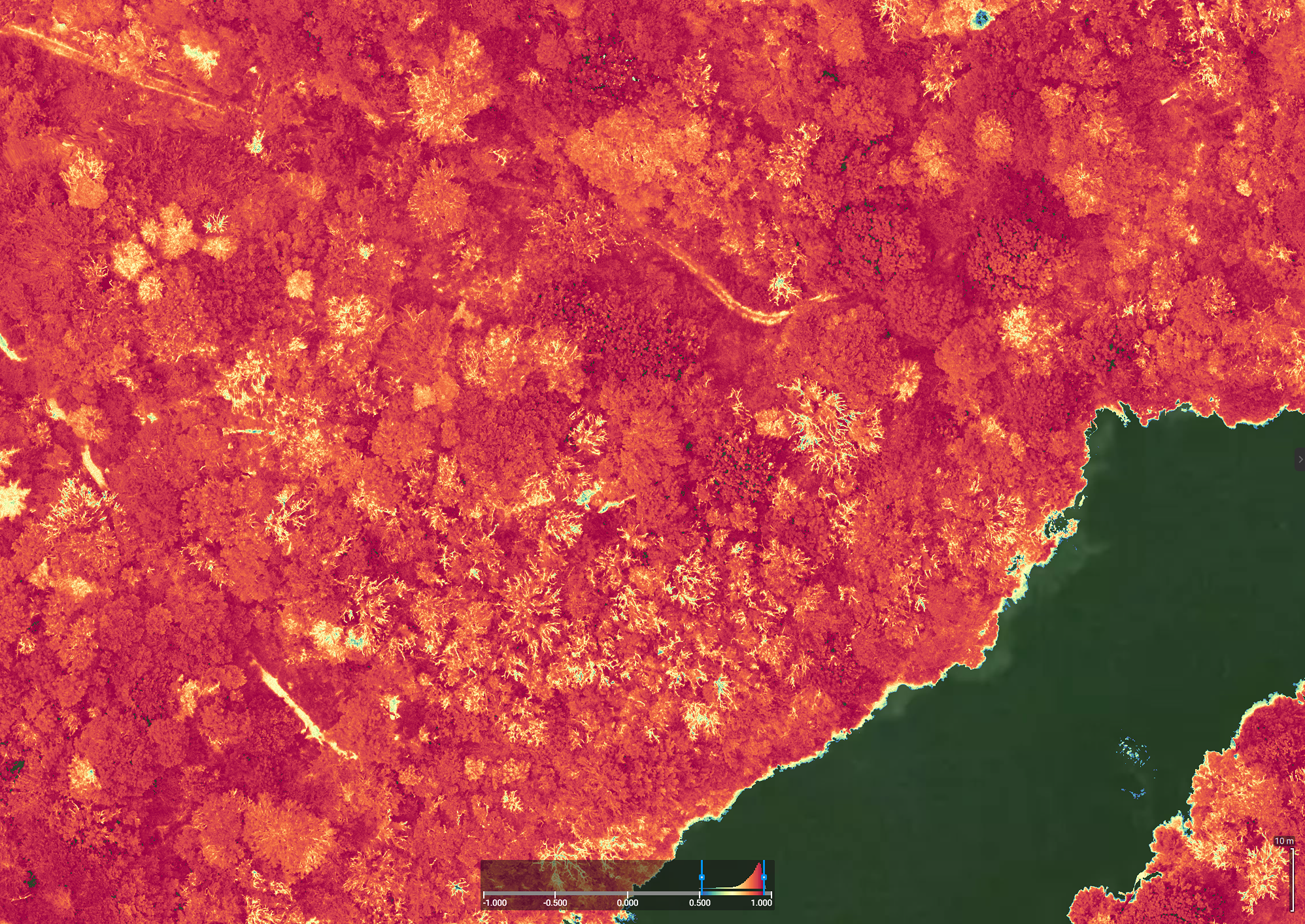
Multispectral monitoring is a useful tool in forestry for monitoring the health of the forest canopy and the stresses upon the forest. Using multispectral drone imaging we can assess the impact of pests, disease, poor soil and lack of water. Orthomosaic multispectral maps allow for rapid identification of forest health and easy identification of diseases like Ash dieback (Hymenoscyphus fraxineus).
Thermal Imaging in Forests
Drone mounted thermal cameras can help in surveying large areas of forestry for large animals, such as deer. The drones’ infrared sensors capture thermal images of deer, which can be geo-located, allowing forest managers to assess the size of the deer population and the distribution of the deer throughout the forest. By combining the imagery and point locations of the deer with a GIS mapping application, land managers can build up an in-depth understanding of wildlife populations to support population management activity.


